File:MAP2.JPG
From OzWiki
Jump to navigationJump to search
No higher resolution available.
MAP2.JPG (710 × 500 pixels, file size: 134 KB, MIME type: image/jpeg)
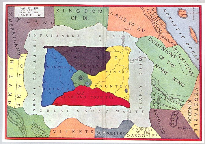
The first published map of the countries near Oz.
File history
Click on a date/time to view the file as it appeared at that time.
| Date/Time | Thumbnail | Dimensions | User | Comment | |
|---|---|---|---|---|---|
| current | 17:10, 13 October 2010 | | 710 × 500 (134 KB) | Ericgjovaag (talk | contribs) | The first published map of the countries near Oz. |
You cannot overwrite this file.
File usage
The following page uses this file: